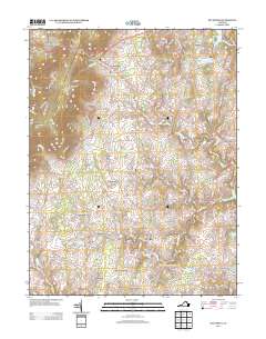
2013 Map of Bluemont
USGS Topo · Published 2013About this map
Snickers Gap serves as a prominent gateway through the Blue Ridge Mountain range, marking the western edge of this Loudoun County landscape. The settlement of Bluemont sits at the foot of the ridge, where the historic Snickersville Tpke begins its descent toward the rolling Piedmont. This 2013 survey reveals a traditional Virginia countryside defined by small, long-established hamlets and agricultural estates. Features like Old Welbourne and Ayrshire Farm highlight the area's equestrian and farming heritage, while small historic communities such as Unison, Willisville, and Saint Louis maintain their distinct footprints along secondary roads. The drainage pattern is defined by the winding course of Beaverdam Cr and numerous smaller branches like Dog Br and Jeffries Br, which fed the region's early mills and farms. To the northeast, the topography transitions toward Round Top and the waters of Sleeter Lake.
Find a feature on this map
145 named features on this map. Tap any name to fly to it.
Don’t see what you’re looking for? This feature index may not catch every label — zoom into the map to look around manually.
Map Details
Editions of this 2013 Bluemont Map
This is the sole edition of this map. No revisions or reprints were ever made.
Other maps of this area

1884 · Harpers Ferry
USGS Topo · 1:125,000

1891 · Harpers Ferry
USGS Topo · 1:125,000

1893 · Harpers Ferry
USGS Topo · 1:125,000

1894 · Warrenton
USGS Topo · 1:125,000

1916 · Berryville
USGS Topo · 1:62,500

1933 · Middleburg
USGS Topo · 1:62,500

1939 · Berryville
USGS Topo · 1:48,000

1943 · Bluemont
USGS Topo · 1:24,000
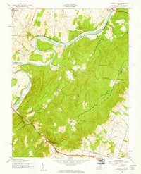
1943 · Ashby Gap
USGS Topo · 1:24,000

1943 · Upperville
USGS Topo · 1:24,000