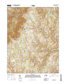
2016 Map of Bluemont
USGS Topo · Published 2016About this map
The Blue Ridge crest forms a natural boundary on this modern survey, where the border between Clarke Co and Loudon Co follows the high ground. Near Snickers Gap, the Appalachian National Scenic Trail winds through the northern corner, overlooking a landscape of long-established Piedmont villages. The settlement pattern here is remarkably dense with historical hamlets such as Bluemont, Unison, Willisville, and Saint Louis. These communities are connected by a web of traditional routes like the Snickersville Tpke and Airmont Rd, which navigate around prominent terrain features like Round Top and Black Oak Ridge. Water resources, including Sleeter Lake and the N Fork Goose Cr, are central to the region's geography, supporting local landmarks such as Meadow Grove Farm Lake and the historical Ebenezer Cem.
Find a feature on this map
118 named features on this map. Tap any name to fly to it.
Don’t see what you’re looking for? This feature index may not catch every label — zoom into the map to look around manually.
Map Details
Editions of this 2016 Bluemont Map
This is the sole edition of this map. No revisions or reprints were ever made.
Other maps of this area

1884 · Harpers Ferry
USGS Topo · 1:125,000

1891 · Harpers Ferry
USGS Topo · 1:125,000

1893 · Harpers Ferry
USGS Topo · 1:125,000

1894 · Warrenton
USGS Topo · 1:125,000

1916 · Berryville
USGS Topo · 1:62,500

1933 · Middleburg
USGS Topo · 1:62,500

1939 · Berryville
USGS Topo · 1:48,000

1943 · Bluemont
USGS Topo · 1:24,000
1943 · Ashby Gap
USGS Topo · 1:24,000

1943 · Upperville
USGS Topo · 1:24,000