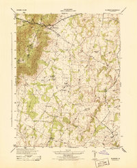
1944 Map of Bluemont
USGS Topo · Published 1944About this map
Snickers Gap serves as the focal point of the Blue Ridge crossing on this 1940s survey, where the Appalachian Trail follows the high ridgeline along the border of Clarke and Loudoun County. The settlement of Bluemont is positioned at the base of this mountain pass, marking the transition from the steep terrain of Bear Den Park to the rolling agricultural landscape to the east. This era of Virginia countryside is defined by a dense network of local schools and churches, including Pine Grove School, Good Shepherd Church, and Rock Hill School, illustrating a deeply established rural community.
Find a feature on this map
29 named features on this map. Tap any name to fly to it.
Don’t see what you’re looking for? This feature index may not catch every label — zoom into the map to look around manually.
Map Details
Editions of this 1944 Bluemont Map
This is the sole edition of this map. No revisions or reprints were ever made.
Other maps of this area

1884 · Harpers Ferry
USGS Topo · 1:125,000

1891 · Harpers Ferry
USGS Topo · 1:125,000

1893 · Harpers Ferry
USGS Topo · 1:125,000

1894 · Warrenton
USGS Topo · 1:125,000

1916 · Berryville
USGS Topo · 1:62,500

1933 · Middleburg
USGS Topo · 1:62,500

1939 · Berryville
USGS Topo · 1:48,000

1943 · Bluemont
USGS Topo · 1:24,000
1943 · Ashby Gap
USGS Topo · 1:24,000

1943 · Upperville
USGS Topo · 1:24,000