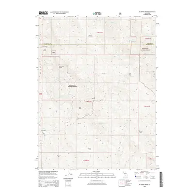
2015 Map of Bluenose Ridge
USGS Topo · Published 2015About this map
Mendocino National Forest defines the character of this 2015 survey, which straddles the rugged boundary between Trinity and Mendocino counties. The landscape is dominated by high-altitude features and clearings, including Jose Opening and the broad plateau of Big Flat. Named for its prominent peaks and ridgelines, the area features significant landmarks like Castle Peak and Buck Mtn, while Crazy Bear Pass provides a transition between drainage basins. A network of creeks, including the winding Hulls Cr, Pepperwood Cr, and Cassoose Cr, carves through the forest, revealing the complex topography of Asa Bean Ridge and the eponymous Bluenose Ridge. Human presence is sparse, represented by Hulls Valley Rd and specialized locations like Lightning Camp Ridge, emphasizing the remote, wilderness character of these northern California highlands.
Find a feature on this map
34 named features on this map. Tap any name to fly to it.
Don’t see what you’re looking for? This feature index may not catch every label — zoom into the map to look around manually.
Map Details
Editions of this 2015 Bluenose Ridge Map
This is the sole edition of this map. No revisions or reprints were ever made.
Other maps of this area

1920 · Covelo
USGS Topo · 1:62,500

1921 · Hoaglin
USGS Topo · 1:62,500

1922 · Island Mountain
USGS Topo · 1:62,500

1926 · Covelo
USGS Topo · 1:62,500

1931 · Hoaglin
USGS Topo · 1:96,000

1935 · Hoaglin
USGS Topo · 1:125,000

1952 · Spyrock
USGS Topo · 1:62,500

1952 · Covelo
USGS Topo · 1:62,500

1953 · Blackrock Mtn
USGS Topo · 1:62,500

1954 · Blackrock Mtn
USGS Topo · 1:62,500