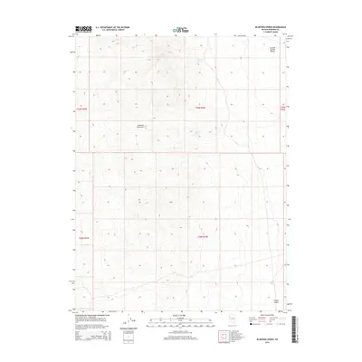
2014 Map of Bluewing Spring
USGS Topo · Published 2014About this map
The Sahwave Mountains dominate this high-desert landscape in Pershing County, marking a stark transition between the arid basins of Granite Springs Valley to the north and Copper Valley to the south. Historically significant water sources are documented here, including Bluewing Spring and Granite Spring, which have long served as vital points of interest in this arid terrain. The map's detailed grid reflects the Public Land Survey System divisions, showing the junction of multiple townships including t26n r26e and t25n r26e. This survey captures the region's topographical character, where isolated springs provide the only relief in a vast mountain-and-valley system.
Find a feature on this map
10 named features on this map. Tap any name to fly to it.
Don’t see what you’re looking for? This feature index may not catch every label — zoom into the map to look around manually.
Map Details
Editions of this 2014 Bluewing Spring Map
This is the sole edition of this map. No revisions or reprints were ever made.
Other maps of this area

1886 · Granite Range
USGS Topo · 1:250,000

1890 · Wadsworth
USGS Topo · 1:125,000

1892 · Wadsworth
USGS Topo · 1:125,000

1894 · Granite Range
USGS Topo · 1:250,000

1894 · Wadsworth
USGS Topo · 1:125,000

1908 · Carson Sink
USGS Topo · 1:250,000

1910 · Carson Sink
USGS Topo · 1:250,000

1931 · Lovelock
USGS Topo · 1:250,000

1935 · Lovelock
USGS Topo · 1:250,000

1951 · Desert Peak
USGS Topo · 1:62,500