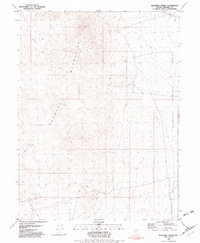
1981 Map of Bluewing Spring
USGS Topo · Published 1982About this map
The Sahwave Mountains dominate this high-desert terrain, creating a dramatic physical barrier that separates the basin floor to the east. Within these arid heights, the presence of Bluewing Spring and Granite Spring points to the vital water sources that supported early travelers and local wildlife. The landscape is marked by evidence of historical mineral exploration, particularly in the southwestern reaches where several Mines and a single Mine are indicated along the slopes.
Find a feature on this map
7 named features on this map. Tap any name to fly to it.
Don’t see what you’re looking for? This feature index may not catch every label — zoom into the map to look around manually.
Map Details
Editions of this 1981 Bluewing Spring Map
This is the sole edition of this map. No revisions or reprints were ever made.
Other maps of this area

1886 · Granite Range
USGS Topo · 1:250,000

1890 · Wadsworth
USGS Topo · 1:125,000

1892 · Wadsworth
USGS Topo · 1:125,000

1894 · Granite Range
USGS Topo · 1:250,000

1894 · Wadsworth
USGS Topo · 1:125,000

1908 · Carson Sink
USGS Topo · 1:250,000

1910 · Carson Sink
USGS Topo · 1:250,000

1931 · Lovelock
USGS Topo · 1:250,000

1935 · Lovelock
USGS Topo · 1:250,000

1951 · Desert Peak
USGS Topo · 1:62,500