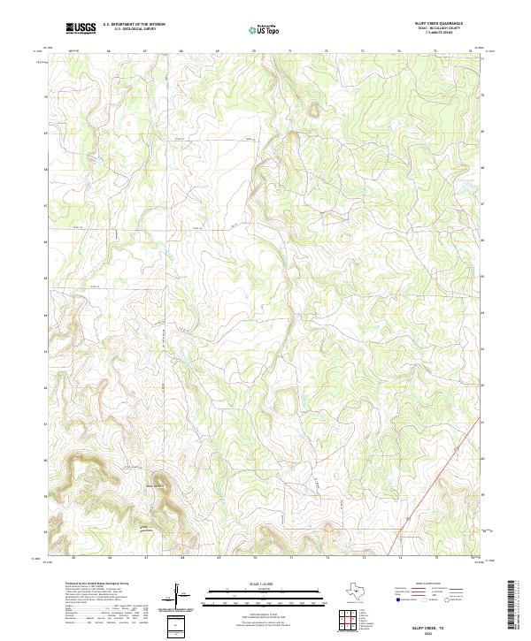
2022 Map of Bluff Creek
USGS Topo · Published 2022About this map
The Brady Mountains anchor the southwestern corner of this West Texas landscape, where the terrain transitions into a series of drainages feeding the Colorado River watershed. A prominent landmark, Table Top Mtn, rises above a network of ranch roads and private tracks, including the historically named Old Santa Anna Rd. This corridor represents a sparse but functional ranching infrastructure where water management is critical, evidenced by features like the China Tank in the northeast. The hydrology is defined by the seasonal flow of Bluff Cr and the divided headwaters of E Fork Cow Cr and W Fork Cow Cr. These intermittent streams carve through the limestone plateau, dictating the placement of primitive roads and cattle fencing in a region where geography remains the primary driver of human movement and land use.
Find a feature on this map
21 named features on this map. Tap any name to fly to it.
Don’t see what you’re looking for? This feature index may not catch every label — zoom into the map to look around manually.
Map Details
Editions of this 2022 Bluff Creek Map
This is the sole edition of this map. No revisions or reprints were ever made.
Other maps of this area

1894 · Brady
USGS Topo · 1:125,000

1924 · Brady 2-a
USGS Topo · 1:48,000

1925 · Brady 2-b
USGS Topo · 1:48,000

1925 · Brady 1-b
USGS Topo · 1:48,000

1928 · Mercury
USGS Topo · 1:62,500

1928 · Waldrip
USGS Topo · 1:62,500

1950 · Mercury
USGS Topo · 1:62,500

1954 · Brownwood
USGS Topo · 1:250,000

1960 · West Sweden
USGS Topo · 1:24,000

1960 · Brady North
USGS Topo · 1:24,000