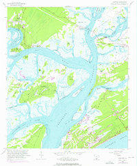
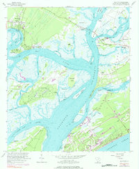
1956 Map of Bluffton
USGS Topo · Published 1976About this map
Bluffton and the surrounding Sea Islands appear here during a transformative era of coastal development in the mid-1950s, with later revisions showing the growth of Hilton Head Island through the early 1970s. The landscape is defined by a labyrinth of tidal waterways, including the May River, Calibogue Sound, and Skull Creek. While Bluffton is established on the mainland bluffs, the islands show a mix of older agricultural footprints and emerging recreation, evidenced by several Golf Courses. Genealogists will find significant value in the numerous family and plantation-era burial sites, such as Stoney Cem, Lawton Cem, and Haig Point Cem on Daufuskie Island. The transition from river-based transport to modern infrastructure is marked by the Toll Bridge at Buckingham Landing and the County Dock near Hilton Head Harbor, while the presence of the Barnard Ruins points to the area's deeper colonial and antebellum history.
Find a feature on this map
80 named features on this map. Tap any name to fly to it.
Don’t see what you’re looking for? This feature index may not catch every label — zoom into the map to look around manually.
Map Details
Editions of this 1956 Bluffton Map
5 editions found
Other maps of this area

1920 · Okatie
USGS Topo · 1:62,500

1920 · Hilton Head
USGS Topo · 1:62,500

1920 · Bluffton
USGS Topo · 1:62,500

1942 · Okatie
USGS Topo · 1:62,500

1944 · Fort Fremont
USGS Topo · 1:62,500

1945 · Bluffton
USGS Topo · 1:62,500

1945 · Hilton Head
USGS Topo · 1:62,500

1947 · Savannah
USGS Topo · 1:250,000

1948 · Savannah
USGS Topo · 1:250,000
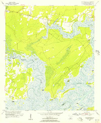
1955 · Pritchardville
USGS Topo · 1:24,000
Featured Places
- Hilton Head Island, SC
- Bluffton, SC
- Buckingham Landing, SC
- Myrtle Island, SC
- Coligny, Hilton Head Island