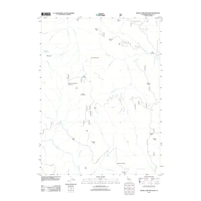
2012 Map of Board Camp Mountain
USGS Topo · Published 2012About this map
Dinsmores sits at the edge of this Humboldt County terrain, where the Mad River carves through a landscape defined by dramatic ridgelines and isolated outposts. The 2012 survey documents a series of established homesteads and high-elevation shelters, including Bartlett Ranch in the north and Deer Creek Ranch to the south. Notable landmarks such as Nolan Cabin, Upper Joe Green Cabin, and Ridge Cabin highlight a history of seasonal occupation and ranching. The topographic structure is punctuated by named clearings or "openings," such as White Oak Opening and Starvation Opening, which suggest specific localized grazing or logging histories. High points like Board Camp Mountain Tri Board Camp and Board Camp Butte dominate the central geography, overlooking a complex drainage network that includes Grouse Cr and Redwood Cr. The map also traces established routes like the S Fork Mountain Rd and Whiting Ridge Trl, essential for navigating this interior forest territory.
Find a feature on this map
65 named features on this map. Tap any name to fly to it.
Don’t see what you’re looking for? This feature index may not catch every label — zoom into the map to look around manually.
Map Details
Editions of this 2012 Board Camp Mountain Map
This is the sole edition of this map. No revisions or reprints were ever made.
Other maps of this area

1914 · Pilot Creek
USGS Topo · 1:62,500

1915 · Big Bar and Vicinity
USGS Topo · 1:250,000

1922 · Korbel
USGS Topo · 1:62,500

1922 · China Flat
USGS Topo · 1:62,500

1922 · Kneeland
USGS Topo · 1:62,500

1945 · Blue Lake
USGS Topo · 1:62,500

1950 · Iaqua Buttes
USGS Topo · 1:62,500

1951 · Pilot Creek
USGS Topo · 1:62,500

1951 · Blue Lake
USGS Topo · 1:62,500

1952 · Willow Creek
USGS Topo · 1:62,500