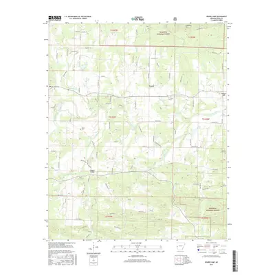
2017 Map of Board Camp
USGS Topo · Published 2017About this map
Board Camp and Cherry Hill anchor this rural landscape in the western Arkansas mountains, where the Ouachita River flows eastward across the center of the sheet. The settlement pattern is defined by family-named landmarks and historical community centers like Yocana and Ink. Genealogy and local history are preserved through several burial grounds, including Board Camp Cem, Liberty Cem, and Lower Big Fork Cem. The northern and southern portions of the map are characterized by the steep elevations of the Ouachita National Forest, with Goldsberry Mtn dominating the northeastern corner. Extensive forest roads and local lanes, such as Renegade Ln and Polk Road 63, connect these mountain settlements to water sources like Board Camp Cr and Sulphur Cr, illustrating the long-standing reliance on the local creek network for both navigation and agricultural sustenance.
Find a feature on this map
100 named features on this map. Tap any name to fly to it.
Don’t see what you’re looking for? This feature index may not catch every label — zoom into the map to look around manually.
Map Details
Editions of this 2017 Board Camp Map
This is the sole edition of this map. No revisions or reprints were ever made.
Other maps of this area

1890 · Mount Ida
USGS Topo · 1:125,000

1890 · Poteau Mountain
USGS Topo · 1:125,000

1899 · Poteau Mountain
USGS Topo · 1:125,000

1906 · Caddo Gap
USGS Topo · 1:125,000

1913 · De Queen
USGS Topo · 1:125,000

1936 · Athens
USGS Topo · 1:48,000

1942 · Athens
USGS Topo · 1:62,500

1950 · Mcalester
USGS Topo · 1:250,000

1955 · Little Rock
USGS Topo · 1:250,000

1956 · Little Rock
USGS Topo · 1:250,000