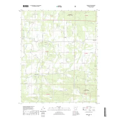
2020 Map of Board Camp
USGS Topo · Published 2020About this map
The Ouachita River snakes across this portion of Polk County, where the valley floor meets the wooded ridges of the Ouachita National Forest. The settlement at Board Camp serves as a local anchor, complete with its Po and the nearby Board Camp Cem. This area reflects a long-standing agricultural and timber-based economy, with small communities like Yocana, Ink, and Cherry Hill situated along a network of forest roads and local lanes. The hydrology of the region is notably diverse, featuring numerous named creeks such as Board Camp Cr, Sulphur Cr, and Loftis Cr, along with several small impoundments including Forbis Lake, Dairy Lake, and J and B Lake. The terrain is characterized by the transition from the river bottomlands to the rising elevations of the surrounding national forest, where the grid of Forest Rd routes provide access to the more secluded valleys.
Find a feature on this map
101 named features on this map. Tap any name to fly to it.
Don’t see what you’re looking for? This feature index may not catch every label — zoom into the map to look around manually.
Map Details
Editions of this 2020 Board Camp Map
This is the sole edition of this map. No revisions or reprints were ever made.
Other maps of this area

1890 · Mount Ida
USGS Topo · 1:125,000

1890 · Poteau Mountain
USGS Topo · 1:125,000

1899 · Poteau Mountain
USGS Topo · 1:125,000

1906 · Caddo Gap
USGS Topo · 1:125,000

1913 · De Queen
USGS Topo · 1:125,000

1936 · Athens
USGS Topo · 1:48,000

1942 · Athens
USGS Topo · 1:62,500

1950 · Mcalester
USGS Topo · 1:250,000

1955 · Little Rock
USGS Topo · 1:250,000

1956 · Little Rock
USGS Topo · 1:250,000