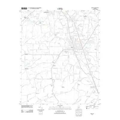
2011 Map of Boaz
USGS Topo · Published 2011About this map
Boaz and the southern reaches of Albertville anchor this 2011 topographic survey, revealing a landscape defined by the intersection of early settlement roots and modern infrastructure. The area is dense with genealogical markers, including numerous burial sites such as Old Mount Vernon Cemetery, Hillcrest Cemetery, and Red Apple Cemetery. These sites are often positioned near established transport routes like Beulah Rd and McDowell Cir. To the south, the terrain shifts significantly as the plateau gives way to the ridges of Aurora Mountain. This southern section is characterized by notable natural passes including Lackey Gap, Jordan Gap, and Lawson Gap, which have historically influenced movement through the region. Small communities and named locales like Mountainboro, Union, and Whitesville are scattered across the map, situated along the drainages of Slab Creek, Clear Creek, and Little Cove Creek.
Find a feature on this map
186 named features on this map. Tap any name to fly to it.
Don’t see what you’re looking for? This feature index may not catch every label — zoom into the map to look around manually.
Map Details
Editions of this 2011 Boaz Map
This is the sole edition of this map. No revisions or reprints were ever made.
Other maps of this area

1885 · Gadsden
USGS Topo · 1:125,000

1888 · Gadsden
USGS Topo · 1:125,000

1892 · Gadsden
USGS Topo · 1:125,000

1895 · Gadsden
USGS Topo · 1:125,000

1903 · Gadsden
USGS Topo · 1:125,000

1936 · Painter
USGS Topo · 1:24,000

1936 · Guntersville
USGS Topo · 1:24,000

1936 · Mountainboro
USGS Topo · 1:24,000

1936 · Rodentown
USGS Topo · 1:24,000

1936 · High Point
USGS Topo · 1:24,000