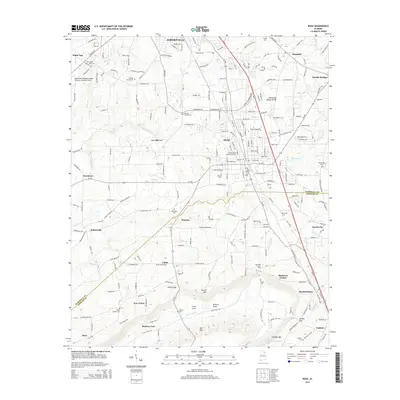
2014 Map of Boaz
USGS Topo · Published 2014About this map
The Tennessee Valley Divide cuts through this portion of Marshall and Etowah counties, defining the complex hydrology of the Sand Mountain plateau. The urban centers of Boaz and Albertville dominate the northern half of the sheet, where established residential grids meet industrial zones and the Snead State Community College campus. In the rural southern sections, the landscape transitions into a series of distinctive geological features such as Bristow Cove, Little Cove, and Jordan Gap. Numerous family and community burial grounds, including Hillcrest Cem, Beulah Cem, and Red Apple Cem, are distributed across the countryside, offering vital points of reference for genealogical research. The transportation network is anchored by Us-431, which links the larger settlements to smaller communities like Sardis City, Mountainboro, and Whitesville.
Find a feature on this map
58 named features on this map. Tap any name to fly to it.
Don’t see what you’re looking for? This feature index may not catch every label — zoom into the map to look around manually.
Map Details
Editions of this 2014 Boaz Map
This is the sole edition of this map. No revisions or reprints were ever made.
Other maps of this area

1885 · Gadsden
USGS Topo · 1:125,000

1888 · Gadsden
USGS Topo · 1:125,000

1892 · Gadsden
USGS Topo · 1:125,000

1895 · Gadsden
USGS Topo · 1:125,000

1903 · Gadsden
USGS Topo · 1:125,000

1936 · Painter
USGS Topo · 1:24,000

1936 · Guntersville
USGS Topo · 1:24,000

1936 · Mountainboro
USGS Topo · 1:24,000

1936 · Rodentown
USGS Topo · 1:24,000

1936 · High Point
USGS Topo · 1:24,000