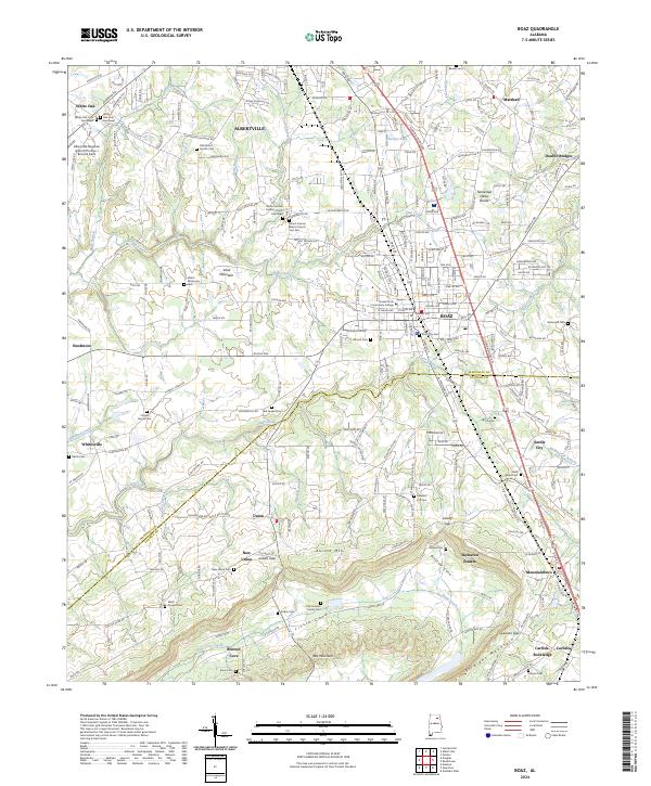
2024 Map of Boaz
USGS Topo · Published 2024About this map
Sand Mountain dominates the landscape of this plateau region, where the town centers of Boaz and Albertville meet near the Tennessee Valley Divide. This 2024 survey documents the dense concentration of civic and spiritual landmarks that define the area's social history, including Snead State Community College and several historic burial grounds such as the Mount Vernon Baptist Church Cem-West and Mount Vernon Baptist Church Cem-East. The terrain shifts significantly at the Marshall Co and Etowah Co line, where the plateau gives way to the ridges of Aurora Mtn and Straight Mountain. This southern portion of the quadrangle is marked by rural settlements like New Union and Bristow Cove, along with topographic breaks such as Lackey Gap and Jordan Gap, which have historically dictated the passage of local travel through the mountain gaps.
Find a feature on this map
261 named features on this map. Tap any name to fly to it.
Don’t see what you’re looking for? This feature index may not catch every label — zoom into the map to look around manually.
Map Details
Editions of this 2024 Boaz Map
This is the sole edition of this map. No revisions or reprints were ever made.
Other maps of this area

1885 · Gadsden
USGS Topo · 1:125,000

1888 · Gadsden
USGS Topo · 1:125,000

1892 · Gadsden
USGS Topo · 1:125,000

1895 · Gadsden
USGS Topo · 1:125,000

1903 · Gadsden
USGS Topo · 1:125,000

1936 · Painter
USGS Topo · 1:24,000

1936 · Guntersville
USGS Topo · 1:24,000

1936 · Mountainboro
USGS Topo · 1:24,000

1936 · Rodentown
USGS Topo · 1:24,000

1936 · High Point
USGS Topo · 1:24,000