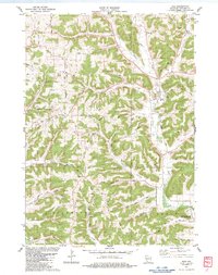
1983 Map of Boaz
USGS Topo · Published 1983About this map
Deeply dissected ridge-and-valley topography characterizes the southwestern Wisconsin landscape around Boaz in the early 1980s. The settlement pattern follows the drainage of Mill Creek and its tributaries, where narrow valley floors provide space for rural crossroads like Nevels Corners and Basswood. The area's social history is visible through scattered institutions such as the Akan Central Sch and the Richland Ch Cem, indicating a community structured around township lines like Akan and Dayton.
Find a feature on this map
52 named features on this map. Tap any name to fly to it.
Don’t see what you’re looking for? This feature index may not catch every label — zoom into the map to look around manually.
Map Details
Editions of this 1983 Boaz Map
This is the sole edition of this map. No revisions or reprints were ever made.
Other maps of this area

1905 · Richland Center
USGS Topo · 1:125,000

1933 · Boaz
USGS Topo · 1:62,500

1933 · Boscobel
USGS Topo · 1:62,500

1958 · La Crosse
USGS Topo · 1:250,000

1960 · Richland Center
USGS Topo · 1:62,500

1960 · Muscoda
USGS Topo · 1:62,500

1961 · La Crosse
USGS Topo · 1:250,000

1965 · La Crosse
USGS Topo · 1:250,000

1966 · Boaz
USGS Topo · 1:62,500
1967 · Boscobel
USGS Topo · 1:62,500