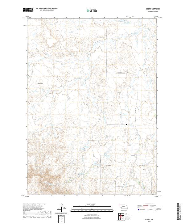
2021 Map of Bodarc
USGS Topo · Published 2021About this map
Sowbelly Canyon and the high plains of Sioux County define this western Nebraska landscape, where water management is central to the local geography. The map reveals a network of man-made water features such as Bill Coffee Reservoir Number 1, Crystal Lake Reservoir, and Zimmerman Reservoir, all strategically placed to capture runoff from seasonal drainages. These systems support the ranching operations that have long occupied this corner of the state.
Find a feature on this map
30 named features on this map. Tap any name to fly to it.
Don’t see what you’re looking for? This feature index may not catch every label — zoom into the map to look around manually.
Map Details
Editions of this 2021 Bodarc Map
This is the sole edition of this map. No revisions or reprints were ever made.
Other maps of this area

1955 · Alliance
USGS Topo · 1:250,000

1957 · Alliance
USGS Topo · 1:250,000

1958 · Alliance
USGS Topo · 1:250,000

1978 · Harrison West
USGS Topo · 1:24,000

1979 · Harrison East
USGS Topo · 1:24,000

1980 · Montrose
USGS Topo · 1:24,000
1980 · Story
USGS Topo · 1:24,000

1980 · Five Points
USGS Topo · 1:24,000

1980 · Andrews
USGS Topo · 1:24,000
1980 · Story NE
USGS Topo · 1:24,000