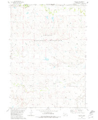
1980 Map of Story NE
USGS Topo · Published 1981About this map
Oglala National Grassland dominates the landscape of this northwest corner of Nebraska, where the arid plains meet the South Dakota border. The terrain is defined by a series of drainage systems, including the meandering paths of Indian Creek, Antelope Creek, and Squaw Creek, which flow toward Hat Creek in the southeast. This 1980s-era study illustrates a sparsely populated ranching environment, centered on family-held operations such as Wasserburger Ranch and Henry Ranch. The presence of several Gravel Pits suggests localized resource extraction to support the area's network of light-duty and unimproved roads. The map serves as a detailed record of land use and water management in Sioux County, documenting numerous stock tanks and windmills essential for maintaining livestock across the expansive open range.
Find a feature on this map
13 named features on this map. Tap any name to fly to it.
Don’t see what you’re looking for? This feature index may not catch every label — zoom into the map to look around manually.
Map Details
Editions of this 1980 Story NE Map
This is the sole edition of this map. No revisions or reprints were ever made.
Other maps of this area

1902 · Edgemont
USGS Topo · 1:125,000

1955 · Hot Springs
USGS Topo · 1:250,000

1955 · Alliance
USGS Topo · 1:250,000

1957 · Alliance
USGS Topo · 1:250,000

1958 · Alliance
USGS Topo · 1:250,000

1980 · Montrose
USGS Topo · 1:24,000
1980 · Story
USGS Topo · 1:24,000

1980 · Five Points
USGS Topo · 1:24,000
1980 · Warbonnet Ranch
USGS Topo · 1:24,000
1980 · Bodarc
USGS Topo · 1:24,000