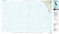
1982 Map of Bodega Bay
USGS Topo · Published 1983About this map
The Russian River winds through several riverside communities including Guerneville, Monte Rio, and Duncans Mills before reaching the Pacific at Jenner. This 1982 survey illustrates a stretch of the Northern California coast dominated by protected lands and research facilities, such as the University of California Marine Laboratory near the Lighthouse at Bodega Bay. Coastal geography is detailed with prominent landmarks like Duncans Point and Red Hill, alongside the extensive Sonoma Coast State Beach.
Find a feature on this map
44 named features on this map. Tap any name to fly to it.
Don’t see what you’re looking for? This feature index may not catch every label — zoom into the map to look around manually.
Map Details
Editions of this 1982 Bodega Bay Map
This is the sole edition of this map. No revisions or reprints were ever made.
Other maps of this area

1916 · Point Reyes
USGS Topo · 1:48,000

1918 · Point Reyes
USGS Topo · 1:62,500

1920 · Healdsburg
USGS Topo · 1:62,500

1921 · Skaggs
USGS Topo · 1:62,500

1921 · Plantation
USGS Topo · 1:62,500

1933 · Healdsburg
USGS Topo · 1:48,000

1935 · Sebastopol
USGS Topo · 1:48,000

1940 · Healdsburg
USGS Topo · 1:62,500

1942 · Sebastopol
USGS Topo · 1:62,500

1942 · Bodega Head
USGS Topo · 1:24,000