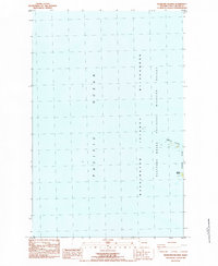
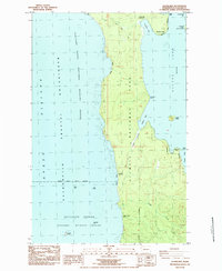
1984 Map of Bodelteh Islands
USGS Topo · Published 1984About this map
The Bodelteh Islands and Ozette Island stand as isolated landmarks off the Clallam County coast, part of a protected maritime environment. This 1984 provisional survey, based on 1977 aerial photography, focuses on these offshore formations within the Washington Islands National Wildlife Refuge Wilderness. The map highlights the coastal hazards and biological significance of the area, noting numerous Rocks, a Rock, and a submerged Reef scattered through the Pacific Ocean. Most prominent are the Flattery Rocks, which define this portion of the Pacific Northwest shoreline. The lack of terrestrial settlements emphasizes the area's status as a dedicated wilderness sanctuary during the late twentieth century.
Find a feature on this map
8 named features on this map. Tap any name to fly to it.
Don’t see what you’re looking for? This feature index may not catch every label — zoom into the map to look around manually.
Map Details
Editions of this 1984 Bodelteh Islands Map
This is the sole edition of this map. No revisions or reprints were ever made.
Other maps of this area

1935 · Ozette Lake
USGS Topo · 1:62,500

1938 · Cape Flattery
USGS Topo · 1:62,500

1942 · Ozette Lake
USGS Topo · 1:62,500

1953 · Cape Flattery
USGS Topo · 1:250,000

1956 · Ozette Lake
USGS Topo · 1:62,500
1957 · Cape Flattery
USGS Topo · 1:62,500

1963 · Cape Flattery
USGS Topo · 1:250,000
1984 · Ozette
USGS Topo · 1:24,000
1984 · Makah Bay
USGS Topo · 1:24,000
1984 · Allens Bay
USGS Topo · 1:24,000