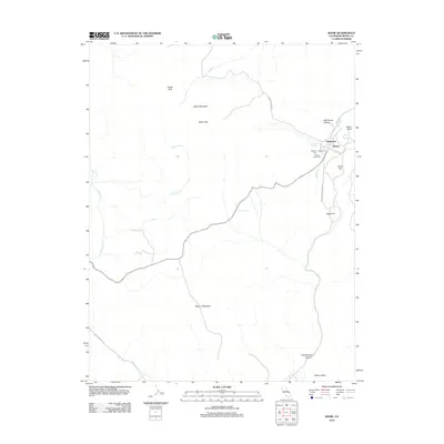
2012 Map of Bodie
USGS Topo · Published 2012About this map
Bodie stands as a focal point in this high-altitude landscape of the Bodie Hills, where the layout of the townsite and adjacent Chinatown remains clearly delineated. The mapping identifies critical sites for genealogical research, including the Masonic Cem, Wards Cem, and Miners Union Cem located just west of the main settlement. These burial grounds, alongside the prominent Silver Hill and Bodie Bluff, suggest the intense mining activity that once defined this district.
Find a feature on this map
25 named features on this map. Tap any name to fly to it.
Don’t see what you’re looking for? This feature index may not catch every label — zoom into the map to look around manually.
Map Details
Editions of this 2012 Bodie Map
This is the sole edition of this map. No revisions or reprints were ever made.
Other maps of this area

1909 · Hawthorne
USGS Topo · 1:250,000

1909 · Bridgeport
USGS Topo · 1:125,000

1911 · Bridgeport
USGS Topo · 1:125,000

1911 · Hawthorne
USGS Topo · 1:250,000

1915 · Hawthorne
USGS Topo · 1:250,000

1920 · Bridgeport
USGS Topo · 1:125,000

1948 · Walker Lake
USGS Topo · 1:250,000

1956 · Aurora
USGS Topo · 1:62,500

1957 · Walker Lake
USGS Topo · 1:250,000

1958 · Bodie
USGS Topo · 1:62,500