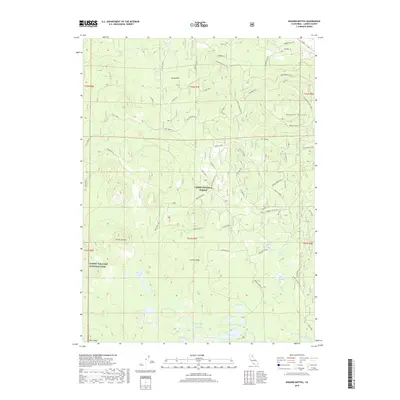
2018 Map of Bogard Buttes
USGS Topo · Published 2018About this map
Lassen National Forest dominates this volcanic landscape, where the high-altitude terrain is defined by the prominent Bogard Buttes and the eastern edge of Lassen Volcanic National Park. This 2018 survey reveals a complex network of forest access routes and specialized spurs, such as Robbers Rd and the Pansey Cutoff, which weave through the timberlands. The hydrological pattern is notable for its numerous alpine basins, including Caribou Lake, Cone Lake, and Tule Lake, which feed into the headwaters of the Susan River. The transition from the rugged volcanic domes like Caribou Peak to the open expanses of Upper Stephens Meadows and Grays Flat illustrates the diverse topography of Lassen County's backcountry. Researchers can trace historical forest management paths and locate remote landmarks like Red Cinder and Black Butte that have long served as primary navigational points in this wilderness.
Find a feature on this map
53 named features on this map. Tap any name to fly to it.
Don’t see what you’re looking for? This feature index may not catch every label — zoom into the map to look around manually.
Map Details
Editions of this 2018 Bogard Buttes Map
This is the sole edition of this map. No revisions or reprints were ever made.
Other maps of this area

1886 · Lassen Peak
USGS Topo · 1:250,000

1892 · Lassen Peak
USGS Topo · 1:250,000

1894 · Lassen Peak
USGS Topo · 1:250,000

1939 · Halls Flat
USGS Topo · 1:125,000

1955 · Westwood
USGS Topo · 1:250,000

1956 · Mt. Harkness
USGS Topo · 1:62,500

1956 · Chester
USGS Topo · 1:62,500

1956 · Harvey Mtn
USGS Topo · 1:62,500

1957 · Prospect Peak
USGS Topo · 1:62,500

1958 · Westwood
USGS Topo · 1:250,000