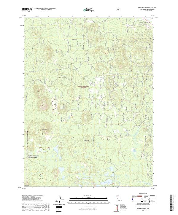
2022 Map of Bogard Buttes
USGS Topo · Published 2022About this map
Lassen National Forest and the northeastern corner of Lassen Volcanic National Park dominate this High Sierra landscape. The terrain is defined by volcanic features, including the prominent volcanic cone of Black Butte and the volcanic domes of the Bogard Buttes. Water is abundant in the southern half of the quadrangle, where a cluster of high-altitude lakes like Caribou Lake, Eleanor Lake, and Jewel Lake sit within the Caribou Wilderness area. The Susan River has its headwaters here, flowing out of the marshes at Cooper Swamp near the eastern boundary. This map captures the intersection of heavy timberlands and protected volcanic wilderness, marked by distinctive cinder cones such as Red Cinder and the high meadowlands of Upper Stephens Meadows. Local infrastructure is sparse, limited to Ca 44 in the north and the forest route of Robbers Spr (DR 10).
Find a feature on this map
32 named features on this map. Tap any name to fly to it.
Don’t see what you’re looking for? This feature index may not catch every label — zoom into the map to look around manually.
Map Details
Editions of this 2022 Bogard Buttes Map
This is the sole edition of this map. No revisions or reprints were ever made.
Other maps of this area

1886 · Lassen Peak
USGS Topo · 1:250,000

1892 · Lassen Peak
USGS Topo · 1:250,000

1894 · Lassen Peak
USGS Topo · 1:250,000

1939 · Halls Flat
USGS Topo · 1:125,000

1955 · Westwood
USGS Topo · 1:250,000

1956 · Mt. Harkness
USGS Topo · 1:62,500

1956 · Chester
USGS Topo · 1:62,500

1956 · Harvey Mtn
USGS Topo · 1:62,500

1957 · Prospect Peak
USGS Topo · 1:62,500

1958 · Westwood
USGS Topo · 1:250,000