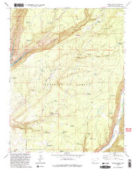
1993 Map of Boggy Draw
USGS Topo · Published 1993About this map
The San Juan National Forest defines this high-plateau landscape, where the storage and movement of water dominate the terrain. A complex system of reservoirs and springs, including Peel Reservoir, Sawmill Reservoir, and Peel Spring, supported the early cattle and timber industries of Montezuma County. The map captures clear evidence of the area's industrial heritage at Rusts Sawmill (Site) and the footprint of a vanished transportation network along the Old Railroad Grade. To the west, the expansive McPhee Reservoir fills the canyons, while the Dolores River cuts through the southeastern corner. This survey is particularly useful for identifying historical land use, showing the locations of old habitations like Morgan Cabin and the network of Pack Trails that once served as the primary routes through the canyons and draws.
Find a feature on this map
61 named features on this map. Tap any name to fly to it.
Don’t see what you’re looking for? This feature index may not catch every label — zoom into the map to look around manually.
Map Details
Editions of this 1993 Boggy Draw Map
2 editions found
Other maps of this area

1956 · Cortez
USGS Topo · 1:250,000

1958 · Cortez
USGS Topo · 1:250,000

1959 · Cortez
USGS Topo · 1:250,000

1962 · Cortez
USGS Topo · 1:250,000

1963 · Stoner
USGS Topo · 1:24,000
1963 · Nipple Mountain
USGS Topo · 1:24,000

1965 · Willow Spring
USGS Topo · 1:24,000

1965 · Dolores East
USGS Topo · 1:24,000

1965 · Dolores West
USGS Topo · 1:24,000
1965 · Millwood
USGS Topo · 1:24,000