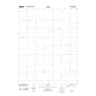
2012 Map of Bogue NW
USGS Topo · Published 2012About this map
Spring Creek meanders through this portion of Graham County, carving a network of drainage patterns across the rural Kansas landscape. The area is characterized by a precise grid of county roads, including north-south corridors like Co Rd-565 and Co Rd-573, which support the scattered agricultural homesteads of the region. Local history is anchored by sites such as Welborn Elementary School in the northwest and two distinct burial grounds: McFarland Cem to the east and Mount Olive Cem near the southern border. The presence of Old Bogue Rd suggests an older transportation corridor that preceded the formalized county road system, providing a link to the historical development of the Bogue vicinity.
Find a feature on this map
16 named features on this map. Tap any name to fly to it.
Don’t see what you’re looking for? This feature index may not catch every label — zoom into the map to look around manually.
Map Details
Editions of this 2012 Bogue NW Map
This is the sole edition of this map. No revisions or reprints were ever made.
Other maps of this area

1893 · Norton
USGS Topo · 1:125,000

1893 · Hill
USGS Topo · 1:125,000

1955 · Beloit
USGS Topo · 1:250,000

1959 · Beloit
USGS Topo · 1:250,000

1969 · Nicodemus
USGS Topo · 1:24,000

1969 · Palco
USGS Topo · 1:24,000

1978 · Edmond SE
USGS Topo · 1:24,000

1979 · Bogue
USGS Topo · 1:24,000
1979 · Logan SW
USGS Topo · 1:24,000

1979 · Hill City South
USGS Topo · 1:24,000