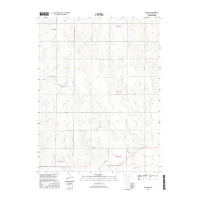
2015 Map of Bogue NW
USGS Topo · Published 2015About this map
S Fork Solomon River defines the southern reach of this Kansas landscape, where the watercourse and its tributaries like Spring Cr have carved the terrain into a network of draws and ridges. This mid-2010s survey reveals a rural landscape organized by a strict section-line road grid, characteristic of the High Plains. Tucked into these sections are small, isolated landmarks of local heritage, including Mount Olive Cem and McFarland Cem, which serve as physical links to the families who settled this portion of Graham County. Small bodies of water like Stevensons Lake dot the western sections, while the thoroughfares, such as Old Bogue Rd, connect these remote homesteads to the wider region. The map captures a moment of modern agricultural life, where vast open spaces are punctuated only by these quiet commemorative sites and intermittent drainage systems.
Find a feature on this map
34 named features on this map. Tap any name to fly to it.
Don’t see what you’re looking for? This feature index may not catch every label — zoom into the map to look around manually.
Map Details
Editions of this 2015 Bogue NW Map
This is the sole edition of this map. No revisions or reprints were ever made.
Other maps of this area

1893 · Norton
USGS Topo · 1:125,000

1893 · Hill
USGS Topo · 1:125,000

1955 · Beloit
USGS Topo · 1:250,000

1959 · Beloit
USGS Topo · 1:250,000

1969 · Nicodemus
USGS Topo · 1:24,000

1969 · Palco
USGS Topo · 1:24,000

1978 · Edmond SE
USGS Topo · 1:24,000

1979 · Bogue
USGS Topo · 1:24,000
1979 · Logan SW
USGS Topo · 1:24,000

1979 · Hill City South
USGS Topo · 1:24,000