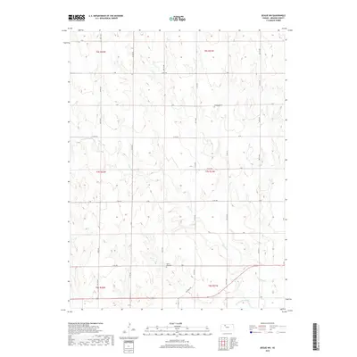
2018 Map of Bogue NW
USGS Topo · Published 2018About this map
S Fork Solomon River defines the southern boundary of this Kansas landscape, where the prairie is carved by the winding drainage of Spring Cr. This territory in Graham County is structured by a rigorous grid of section lines and county roads, reflecting the late twentieth-century agricultural organization of the Great Plains. Cultural landmarks are sparse but significant for genealogical research, notably McFarland Cem in the northeast and Mount Olive Cem near the center of the quadrangle. The network of rural routes, including the historic Old Bogue Rd and numerous numbered avenues like 330 Th Ave, indicates a stable pattern of land use where farmsteads are linked to the primary river valley.
Find a feature on this map
34 named features on this map. Tap any name to fly to it.
Don’t see what you’re looking for? This feature index may not catch every label — zoom into the map to look around manually.
Map Details
Editions of this 2018 Bogue NW Map
This is the sole edition of this map. No revisions or reprints were ever made.
Other maps of this area

1893 · Norton
USGS Topo · 1:125,000

1893 · Hill
USGS Topo · 1:125,000

1955 · Beloit
USGS Topo · 1:250,000

1959 · Beloit
USGS Topo · 1:250,000

1969 · Nicodemus
USGS Topo · 1:24,000

1969 · Palco
USGS Topo · 1:24,000

1978 · Edmond SE
USGS Topo · 1:24,000

1979 · Bogue
USGS Topo · 1:24,000
1979 · Logan SW
USGS Topo · 1:24,000

1979 · Hill City South
USGS Topo · 1:24,000