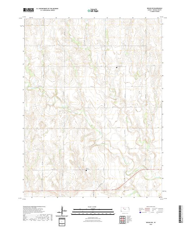
2022 Map of Bogue NW
USGS Topo · Published 2022About this map
S Fork Solomon River cuts through the southern reaches of this Graham County landscape, providing the primary drainage for the area's intricate creek systems. The terrain is defined by the winding course of Spring Cr, which meanders across several sections, creating a network of draws and ridges typical of the High Plains. Evidence of early settlement and family heritage is preserved at McFarland Cem in the north and Mount Olive Cem further south. The map documents a rigid grid of rural transport, including Old Bogue Rd and a series of lettered routes such as Z Rd and U Rd. This layout reflects the enduring township and range system, where remote homesteads and agricultural operations remain connected by these established section-line corridors.
Find a feature on this map
23 named features on this map. Tap any name to fly to it.
Don’t see what you’re looking for? This feature index may not catch every label — zoom into the map to look around manually.
Map Details
Editions of this 2022 Bogue NW Map
This is the sole edition of this map. No revisions or reprints were ever made.
Other maps of this area

1893 · Norton
USGS Topo · 1:125,000

1893 · Hill
USGS Topo · 1:125,000

1955 · Beloit
USGS Topo · 1:250,000

1959 · Beloit
USGS Topo · 1:250,000

1969 · Nicodemus
USGS Topo · 1:24,000

1969 · Palco
USGS Topo · 1:24,000

1978 · Edmond SE
USGS Topo · 1:24,000

1979 · Bogue
USGS Topo · 1:24,000
1979 · Logan SW
USGS Topo · 1:24,000

1979 · Hill City South
USGS Topo · 1:24,000