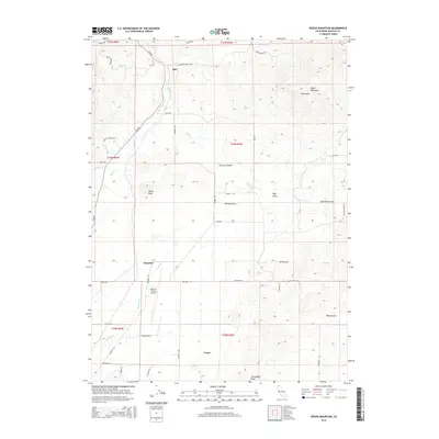
2015 Map of Bogus Mountain
USGS Topo · Published 2015About this map
Shasta Valley dominates the central landscape of this northern California region, where agricultural road networks like Ager Rd and Airport Rd serve a series of small, scattered settlements. The communities of Ager, Snowden, and Logan anchor the valley floor, positioned near the Siskiyou County Airport. The topography shifts dramatically as the valley gives way to the high elevations of Bogus Mountain and Black Mountain to the north and east, marked by steep drainages such as Earhart Canyon and Webb Gulch. Water management is evident through the presence of Oregon Slu and the Kuck Ditch Draw, reflecting the importance of irrigation and drainage in this high-desert environment. Notable peaks like Marys Peak and Terwilliger Peak provide significant landmarks for understanding the local relief between the valley basin and the surrounding volcanic terrain.
Find a feature on this map
48 named features on this map. Tap any name to fly to it.
Don’t see what you’re looking for? This feature index may not catch every label — zoom into the map to look around manually.
Map Details
Editions of this 2015 Bogus Mountain Map
This is the sole edition of this map. No revisions or reprints were ever made.
Other maps of this area

1886 · Shasta
USGS Topo · 1:250,000

1894 · Shasta
USGS Topo · 1:250,000

1922 · Shasta Valley Sheet No 12
USGS Topo · 1:24,000

1922 · Shasta Valley Sheet No 4
USGS Topo · 1:24,000

1922 · Shasta Valley Sheet No 13
USGS Topo · 1:24,000

1922 · Shasta Valley Sheet No 14
USGS Topo · 1:24,000

1922 · Shasta Valley Sheet No 5
USGS Topo · 1:24,000

1932 · Yreka
USGS Topo · 1:96,000

1934 · Macdoel
USGS Topo · 1:96,000

1939 · Yreka
USGS Topo · 1:125,000