
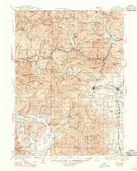
1939 Map of Yreka
USGS Topo · Published 1939About this map
Klamath Mountains and the winding Klamath River dominate this 1930s landscape of Northern California, where gold mining and cattle ranching established the early infrastructure. The map details a region transitioning from its pioneer mining boom, evidenced by numerous named claims like the Commodore Mine, Hegler Mine, and McKinley Mine. The Southern Pacific railroad corridor serves as the primary artery for the eastern valley settlements of Hornbrook, Montague, and Gazelle, while the western reach is defined by the Scott Valley agricultural hub around Fort Jones.
Find a feature on this map
169 named features on this map. Tap any name to fly to it.
Don’t see what you’re looking for? This feature index may not catch every label — zoom into the map to look around manually.
Map Details
Editions of this 1939 Yreka Map
2 editions found
Other maps of this area

1886 · Shasta
USGS Topo · 1:250,000

1891 · Ashland
USGS Topo · 1:250,000

1893 · Ashland
USGS Topo · 1:250,000

1894 · Shasta
USGS Topo · 1:250,000

1897 · Ashland
USGS Topo · 1:250,000

1908 · Grants Pass
USGS Topo · 1:125,000

1914 · Seiad
USGS Topo · 1:125,000

1921 · Shasta Valley Sheet No 7
USGS Topo · 1:24,000

1921 · Shasta Valley Sheet No 1
USGS Topo · 1:24,000

1921 · Shasta Valley Sheet No 6
USGS Topo · 1:24,000