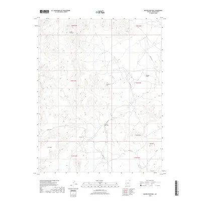
2018 Map of Boiling Over Well
USGS Topo · Published 2018About this map
Boiling Over Well provides a central reference point in this high-desert landscape of Apache County, where the eastern slopes of the Carrizo Mountains meet the northern reaches of the Redrock Valley. This 2018 survey reveals a terrain defined by complex hydrologic networks and distinctive geological monuments, including the Blackhorse Arch and the prominent Elephant Rock. The movement of water is traced through seasonal drainages such as Boiling Over Wash and Pine Wash, which navigate the deep contours of the land. Transportation through this part of the Navajo Nation relies on a network of tribal routes, including Indian Rte 5024 and Indian Rte 332. The map serves as a detailed record of land use in a region where isolated water sources like Hidden Spring and Cove Wash are vital to the local geography.
Find a feature on this map
24 named features on this map. Tap any name to fly to it.
Don’t see what you’re looking for? This feature index may not catch every label — zoom into the map to look around manually.
Map Details
Editions of this 2018 Boiling Over Well Map
This is the sole edition of this map. No revisions or reprints were ever made.
Other maps of this area

1892 · Canyon De Chelly
USGS Topo · 1:250,000

1953 · Los Gigantes NE
USGS Topo · 1:24,000

1953 · Redrock Valley NE
USGS Topo · 1:24,000

1953 · Pastora Peak SW
USGS Topo · 1:24,000

1953 · Redrock Valley SE
USGS Topo · 1:24,000

1953 · Redrock Valley SW
USGS Topo · 1:24,000

1953 · Los Gigantes SE
USGS Topo · 1:24,000

1953 · Redrock Valley NW
USGS Topo · 1:24,000

1953 · Dinne Mesa SE
USGS Topo · 1:24,000

1953 · Pastora Peak SE
USGS Topo · 1:24,000