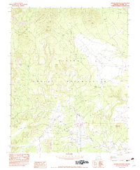
1982 Map of Boiling Over Well
USGS Topo · Published 1982About this map
Navajo Indian Reservation lands dominate this high-desert landscape in the early 1980s, where the northern heights of the Carrizo Mountains overlook a complex network of drainage washes. The map records the isolation and industrial footprint of the era, notably the Toh Thlany Begay Mine situated in the rugged northern terrain. Resource extraction and water management are the primary themes here, evidenced by the eponymous Boiling Over Well (Dry) and scattered water sources like Hidden Spring. The transition from the peaks down into Valley Redrock is marked by seasonal watercourses such as Boiling Over Wash and Blackhorse Creek. A singular Lone Grave and the landmark Black Rock provide specific points of interest for genealogists and local historians, reflecting the sparse but significant human presence in this part of Apache County.
Find a feature on this map
15 named features on this map. Tap any name to fly to it.
Don’t see what you’re looking for? This feature index may not catch every label — zoom into the map to look around manually.
Map Details
Editions of this 1982 Boiling Over Well Map
This is the sole edition of this map. No revisions or reprints were ever made.
Other maps of this area

1892 · Canyon De Chelly
USGS Topo · 1:250,000

1953 · Los Gigantes NE
USGS Topo · 1:24,000

1953 · Redrock Valley NE
USGS Topo · 1:24,000

1953 · Pastora Peak SW
USGS Topo · 1:24,000

1953 · Redrock Valley SE
USGS Topo · 1:24,000

1953 · Redrock Valley SW
USGS Topo · 1:24,000

1953 · Los Gigantes SE
USGS Topo · 1:24,000

1953 · Redrock Valley NW
USGS Topo · 1:24,000

1953 · Dinne Mesa SE
USGS Topo · 1:24,000

1953 · Pastora Peak SE
USGS Topo · 1:24,000