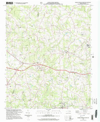
2002 Map of Boiling Springs North
USGS Topo · Published 2003About this map
Lattimore and Mooresboro anchor this detailed study of the southwestern North Carolina Piedmont at the start of the 21st century. The landscape is a network of rural communities defined by long-standing religious and familial centers, including Sandy Run Ch, Plainview Ch, and several family burial grounds like Glover Cem and the McBrayer Cem. Transportation routes and small-town infrastructure are evident in the presence of the McKinney Mill Bridge and a Drive-in Theater near Swainsville.
Find a feature on this map
38 named features on this map. Tap any name to fly to it.
Don’t see what you’re looking for? This feature index may not catch every label — zoom into the map to look around manually.
Map Details
Editions of this 2002 Boiling Springs North Map
This is the sole edition of this map. No revisions or reprints were ever made.
Other maps of this area

1909 · Gaffney
USGS Topo · 1:62,500

1950 · Shelby
USGS Topo · 1:62,500

1953 · Charlotte
USGS Topo · 1:250,000

1954 · Charlotte
USGS Topo · 1:250,000

1959 · Cowpens
USGS Topo · 1:62,500

1960 · Charlotte
USGS Topo · 1:250,000

1962 · Charlotte
USGS Topo · 1:250,000
1965 · Sunshine
USGS Topo · 1:24,000

1966 · Forest City
USGS Topo · 1:24,000
1971 · Boiling Springs South
USGS Topo · 1:24,000