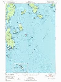
1950 Map of Bois Bubert
USGS Topo · Published 1950About this map
The intricate coastal waters of Washington County are charted here through a complex network of sounds and narrows, dominated by the massive Bois Bubert Island. The map reflects a landscape defined by maritime industry and navigation, where weir fishing was established in Stover Cove and Douglas Island Harbor. The presence of a Chimney on the mainland and a Lighthouse on the southern reaches of Petit Manan Island (appearing in the inset) indicates the vital navigational aids required for sailors passing between Narraguagus Bay and Pleasant Bay.
Find a feature on this map
59 named features on this map. Tap any name to fly to it.
Don’t see what you’re looking for? This feature index may not catch every label — zoom into the map to look around manually.
Map Details
Editions of this 1950 Bois Bubert Map
3 editions found
Other maps of this area

1902 · Cherryfield
USGS Topo · 1:62,500

1904 · Cherryfield
USGS Topo · 1:62,500

1904 · Petit Manan
USGS Topo · 1:62,500

1921 · Great Wass Island
USGS Topo · 1:62,500

1921 · Columbia Falls
USGS Topo · 1:62,500

1941 · Columbia Falls
USGS Topo · 1:62,500

1942 · Cherryfield
USGS Topo · 1:62,500

1942 · Columbia Falls
USGS Topo · 1:62,500

1948 · Drisko Island
USGS Topo · 1:24,000
1948 · Petit Manan
USGS Topo · 1:24,000