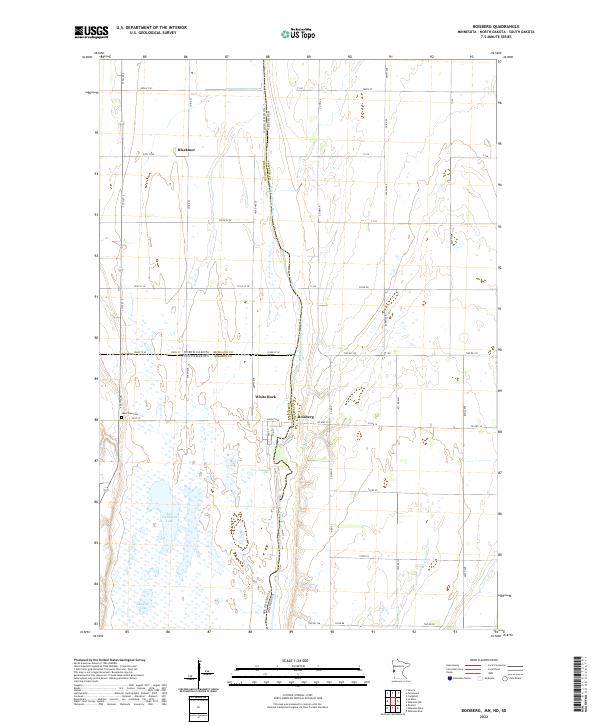
2022 Map of Boisberg
USGS Topo · Published 2022About this map
The Bois de Sioux River forms a critical tri-state junction on this map, serving as the natural boundary between Minnesota, North Dakota, and South Dakota. This northern plains landscape is defined by the proximity of the settlements of Boisberg and White Rock, where the river’s path dictates the convergence of Roberts, Richland, and Traverse counties. To the west, the presence of East Clubhouse Lake and Round Lake amidst the prairie suggest the wetland character of the Bois de Sioux drainage basin.
Find a feature on this map
54 named features on this map. Tap any name to fly to it.
Don’t see what you’re looking for? This feature index may not catch every label — zoom into the map to look around manually.
Map Details
Editions of this 2022 Boisberg Map
This is the sole edition of this map. No revisions or reprints were ever made.
Other maps of this area

1904 · Wahpeton
USGS Topo · 1:125,000

1915 · White Rock
USGS Topo · 1:62,500

1918 · White Rock
USGS Topo · 1:62,500

1951 · Wheaton
USGS Topo · 1:62,500

1951 · Campbell
USGS Topo · 1:62,500

1953 · Milbank
USGS Topo · 1:250,000

1953 · Fargo
USGS Topo · 1:250,000

1956 · Fargo
USGS Topo · 1:250,000

1958 · Milbank
USGS Topo · 1:250,000
1972 · La Mars
USGS Topo · 1:24,000