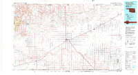
1982 Map of Boise City
USGS Topo · Published 1982About this map
Boise City serves as the focal point of this high-plains landscape, where the iron rails of the Atchison Topeka and Santa Fe railroad bisect the Oklahoma Panhandle. This 1982 revision captures the region's intersection of transit and topography, notably marking the historical route of the Santa Fe Trail as it cuts across the prairie. The terrain transitions from the open stretches of the Rita Blanca National Grassland and Comanche National Grassland to the distinctive volcanic features of the west. Here, the Black Mesa and Sugarloaf Mountain rise above the drainage of the Cimarron River. Smaller settlements like Keyes, Felt, and Wheeless provide crucial reference points for local history and genealogy, while Black Mesa State Park and Lake Etling highlight the area's recreational and water management geography.
Find a feature on this map
45 named features on this map. Tap any name to fly to it.
Don’t see what you’re looking for? This feature index may not catch every label — zoom into the map to look around manually.
Map Details
Editions of this 1982 Boise City Map
This is the sole edition of this map. No revisions or reprints were ever made.
Other maps of this area

1891 · Springfield
USGS Topo · 1:125,000

1892 · Vilas
USGS Topo · 1:125,000

1892 · Mt Carrizo
USGS Topo · 1:125,000

1893 · Springfield
USGS Topo · 1:125,000

1954 · Perryton
USGS Topo · 1:250,000

1954 · Dalhart
USGS Topo · 1:250,000

1955 · La Junta
USGS Topo · 1:250,000

1955 · Dodge City
USGS Topo · 1:250,000

1958 · Perryton
USGS Topo · 1:250,000

1958 · La Junta
USGS Topo · 1:250,000