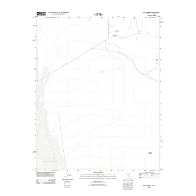
2012 Map of Bole Spring
USGS Topo · Published 2012About this map
Ash Meadows Rancho and its associated Ash Meadows Airport anchor this high-desert landscape in Nye County, Nevada. The area is defined by a sparse but vital network of water sources, including the historic Bole Spring, Grapevine Springs, and Last Chance Spring. These watering points have historically supported local ranching operations, evidenced by the presence of Tubb Ranch and Winters Ranch to the east. The terrain is largely dominated by the arid expanse leading toward Shadow Mountain in the southeast, while the ephemeral Carson Slough defines the western edge. Ash Meadows Road provides the primary transit through this basin, connecting these isolated settlements and springs that represent the survival and industry of the Mojave Desert environment.
Find a feature on this map
13 named features on this map. Tap any name to fly to it.
Don’t see what you’re looking for? This feature index may not catch every label — zoom into the map to look around manually.
Map Details
Editions of this 2012 Bole Spring Map
This is the sole edition of this map. No revisions or reprints were ever made.
Other maps of this area

1908 · Furnace Creek
USGS Topo · 1:250,000

1910 · Furnace Creek
USGS Topo · 1:250,000

1940 · Eagle Tank
USGS Topo · 1:62,500

1948 · Death Valley
USGS Topo · 1:250,000

1951 · Eagle Mtn
USGS Topo · 1:62,500

1952 · Ash Meadows
USGS Topo · 1:62,500

1954 · Death Valley
USGS Topo · 1:250,000

1956 · Death Valley
USGS Topo · 1:250,000

1957 · Death Valley
USGS Topo · 1:250,000

1958 · Death Valley
USGS Topo · 1:250,000