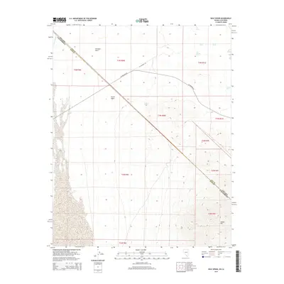
2014 Map of Bole Spring
USGS Topo · Published 2014About this map
Grapevine Springs and a series of vital water sources dot this arid stretch of the borderlands where the Amargosa Desert meets the Mojave Desert. This 2014 survey captures a landscape defined by its scarcity, where names like Big Spring, Bramer Spring, and the namesake Bole Spring represent critical landmarks for survival and navigation in the desert basin. The map illustrates the diagonal intersection of the Nevada-California state line and the county boundary between Nye and Inyo counties. The central transportation artery, Ash Meadows Rd, cuts across the desert floor toward the rising terrain of Shadow Mtn in the southeast. Other distinctive hydrologic features include Last Chance Spring and the curious Winters Holes, while the Carson Slough defines the western edge of this transition zone between two great North American deserts.
Find a feature on this map
22 named features on this map. Tap any name to fly to it.
Don’t see what you’re looking for? This feature index may not catch every label — zoom into the map to look around manually.
Map Details
Editions of this 2014 Bole Spring Map
This is the sole edition of this map. No revisions or reprints were ever made.
Other maps of this area

1908 · Furnace Creek
USGS Topo · 1:250,000

1910 · Furnace Creek
USGS Topo · 1:250,000

1940 · Eagle Tank
USGS Topo · 1:62,500

1948 · Death Valley
USGS Topo · 1:250,000

1951 · Eagle Mtn
USGS Topo · 1:62,500

1952 · Ash Meadows
USGS Topo · 1:62,500

1954 · Death Valley
USGS Topo · 1:250,000

1956 · Death Valley
USGS Topo · 1:250,000

1957 · Death Valley
USGS Topo · 1:250,000

1958 · Death Valley
USGS Topo · 1:250,000