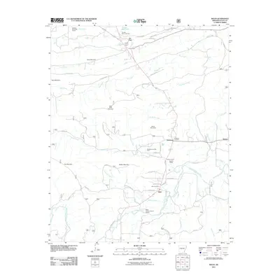
2011 Map of Boles
USGS Topo · Published 2011About this map
Boles and the surrounding Scott County landscape are defined by the winding course of the Fourche LaFave River and its numerous tributaries. This Arkansas terrain is shaped by a series of prominent ridges, including Buffalo Mountain, Bruce Mountain, and High Point Mountain, which separate the various creek valleys. Settlement patterns follow the lowlands, with the Boles Post Office serving as a central point for the rural community.
Find a feature on this map
71 named features on this map. Tap any name to fly to it.
Don’t see what you’re looking for? This feature index may not catch every label — zoom into the map to look around manually.
Map Details
Editions of this 2011 Boles Map
This is the sole edition of this map. No revisions or reprints were ever made.
Other maps of this area

1879 · Poteau Mountain
USGS Topo · 1:62,500

1887 · Poteau Mountain #1
USGS Topo · 1:62,500

1887 · Mount Ida #2
USGS Topo · 1:62,500

1890 · Mount Ida
USGS Topo · 1:125,000

1890 · Poteau Mountain
USGS Topo · 1:125,000

1899 · Poteau Mountain
USGS Topo · 1:125,000

1939 · Waldron
USGS Topo · 1:62,500

1940 · Waldron
USGS Topo · 1:62,500

1941 · Waldron
USGS Topo · 1:62,500

1949 · Waldron
USGS Topo · 1:62,500