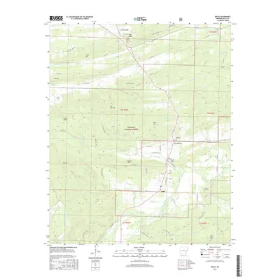
2017 Map of Boles
USGS Topo · Published 2017About this map
The Ouachita National Forest dominates this Scott County landscape, where the ridges of High Point Mtn and Buffalo Mtn rise above a network of creek drainages. The settlement of Boles serves as a local crossroads near the Fourche LaFave River, while smaller communities like Needmore and The Pines are connected by a system of rural county roads. For those researching local lineages, the map identifies several significant burial sites including the Needmore Cem, Buffalo Cem, and the Countiss Grave Yard. The presence of Buffalo Bridge and numerous family-named landmarks like Truman Baker Lake suggests a long-standing pattern of rural land use. The topography is defined by the east-west orientation of ridges like Bruton Ridge and Key Mtn, which have historically dictated the placement of roads and homesteads within the forest boundaries.
Find a feature on this map
73 named features on this map. Tap any name to fly to it.
Don’t see what you’re looking for? This feature index may not catch every label — zoom into the map to look around manually.
Map Details
Editions of this 2017 Boles Map
This is the sole edition of this map. No revisions or reprints were ever made.
Other maps of this area

1879 · Poteau Mountain
USGS Topo · 1:62,500

1887 · Poteau Mountain #1
USGS Topo · 1:62,500

1887 · Mount Ida #2
USGS Topo · 1:62,500

1890 · Mount Ida
USGS Topo · 1:125,000

1890 · Poteau Mountain
USGS Topo · 1:125,000

1899 · Poteau Mountain
USGS Topo · 1:125,000

1939 · Waldron
USGS Topo · 1:62,500

1940 · Waldron
USGS Topo · 1:62,500

1941 · Waldron
USGS Topo · 1:62,500

1949 · Waldron
USGS Topo · 1:62,500