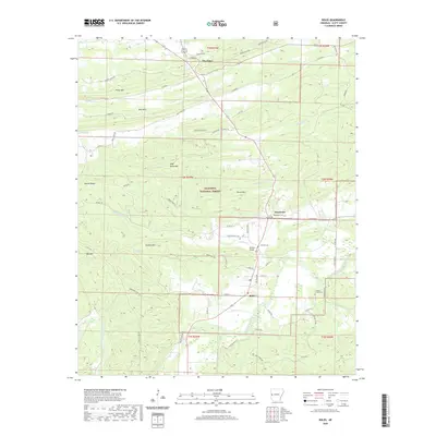
2020 Map of Boles
USGS Topo · Published 2020About this map
Boles and the surrounding Scott County landscape are defined by the convergence of several major watercourses and the ridges of the Ouachita National Forest. The Fourche LaFave River winds through the southeastern corner, while Buffalo Cr and Northern Cr drain the central valleys. The map documents several significant local landmarks for researchers, including the Buffalo Bridge and the small settlements of Needmore and The Pines. For those interested in family history, the locations of Needmore Cem, Buffalo Cem, and the Countiss Grave Yard provide clear markers of the area's rural heritage. Steep terrain is ever-present, with High Point Mtn, Ross Mtn, and Bruton Ridge creating natural boundaries for the winding timber roads and farm lanes that connect these isolated communities.
Find a feature on this map
108 named features on this map. Tap any name to fly to it.
Don’t see what you’re looking for? This feature index may not catch every label — zoom into the map to look around manually.
Map Details
Editions of this 2020 Boles Map
This is the sole edition of this map. No revisions or reprints were ever made.
Other maps of this area

1879 · Poteau Mountain
USGS Topo · 1:62,500

1887 · Poteau Mountain #1
USGS Topo · 1:62,500

1887 · Mount Ida #2
USGS Topo · 1:62,500

1890 · Mount Ida
USGS Topo · 1:125,000

1890 · Poteau Mountain
USGS Topo · 1:125,000

1899 · Poteau Mountain
USGS Topo · 1:125,000

1939 · Waldron
USGS Topo · 1:62,500

1940 · Waldron
USGS Topo · 1:62,500

1941 · Waldron
USGS Topo · 1:62,500

1949 · Waldron
USGS Topo · 1:62,500