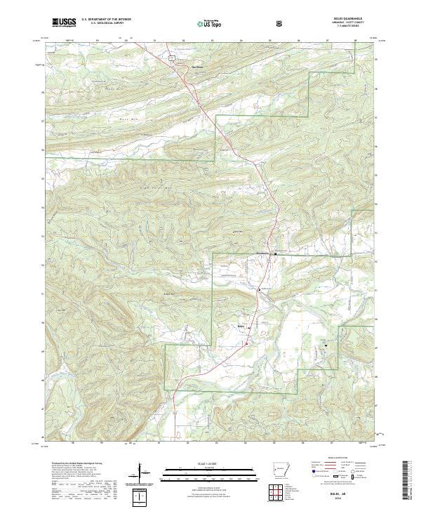
2024 Map of Boles
USGS Topo · Published 2024About this map
Boles and Needmore anchor this Scott County landscape, where the Fourche LaFave River meanders through the southern valleys of the Ouachita National Forest. The map captures a topography defined by significant elevations, including High Point Mtn, Buffalo Mtn, and Bruton Ridge. A network of rural roads such as Ross Creek Rd and Dipping Vat Rd connects isolated settlements and homesteads to US Highway 71. The northern reach is marked by The Pines near Truman Baker Lake, while the local heritage is preserved in several burial grounds, including Needmore Cem, Buffalo Cem, and Dooley Cem. This survey illustrates the intricate drainage patterns of the Ouachita foothills, with numerous waterways like Buffalo Creek, Northern Creek, and Ross Creek feeding the larger river system. The settlement pattern remains closely tied to the valleys between these prominent ridges.
Find a feature on this map
80 named features on this map. Tap any name to fly to it.
Don’t see what you’re looking for? This feature index may not catch every label — zoom into the map to look around manually.
Map Details
Editions of this 2024 Boles Map
This is the sole edition of this map. No revisions or reprints were ever made.
Other maps of this area

1879 · Poteau Mountain
USGS Topo · 1:62,500

1887 · Poteau Mountain #1
USGS Topo · 1:62,500

1887 · Mount Ida #2
USGS Topo · 1:62,500

1890 · Mount Ida
USGS Topo · 1:125,000

1890 · Poteau Mountain
USGS Topo · 1:125,000

1899 · Poteau Mountain
USGS Topo · 1:125,000

1939 · Waldron
USGS Topo · 1:62,500

1940 · Waldron
USGS Topo · 1:62,500

1941 · Waldron
USGS Topo · 1:62,500

1949 · Waldron
USGS Topo · 1:62,500