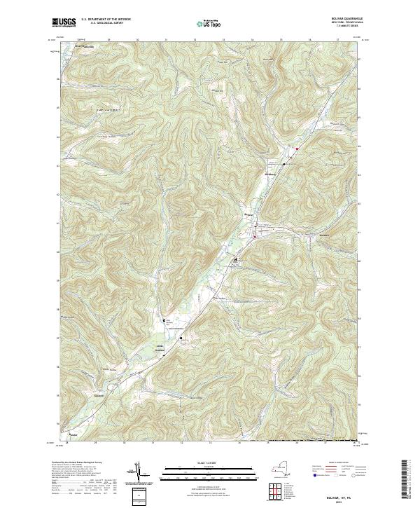
2023 Map of Bolivar
USGS Topo · Published 2023About this map
Little Genesee Creek dictates the movement of people and commerce through this corner of Allegany County, carving a path for modern travel through the high ridges of the Southern Tier. The valley settlements of Richburg, Bolivar, and Little Genesee are tightly clustered along this waterway, connected by the historical corridors of S Main St and Rte 275. Genealogy researchers can locate several significant burial grounds, including the Maple Lawn Cem and Saint Marys Cem, which mark the community centers of these long-established villages.
Find a feature on this map
92 named features on this map. Tap any name to fly to it.
Don’t see what you’re looking for? This feature index may not catch every label — zoom into the map to look around manually.
Map Details
Editions of this 2023 Bolivar Map
This is the sole edition of this map. No revisions or reprints were ever made.
Other maps of this area

1898 · Olean
USGS Topo · 1:62,500

1925 · Belmont
USGS Topo · 1:62,500

1933 · Smethport
USGS Topo · 1:62,500

1934 · Coudersport
USGS Topo · 1:48,000

1937 · Smethport
USGS Topo · 1:62,500

1938 · Coudersport
USGS Topo · 1:62,500

1938 · Olean
USGS Topo · 1:62,500

1939 · Belmont
USGS Topo · 1:62,500

1943 · Olean
USGS Topo · 1:62,500

1957 · Warren
USGS Topo · 1:250,000