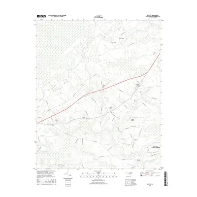
2016 Map of Bolivia
USGS Topo · Published 2016About this map
Bolivia and its surrounding coastal plain communities are defined by a complex network of wetlands and drainage basins in this 2016 survey. The landscape is dominated by named swamps and branches, including the Beaverdam Swamp and Bell Swamp, which feed into the Lockwoods Folly River. Small settlements such as New Hope, Piney Grove, and the uniquely named Half Hell dot the area, connected by a web of rural roads like Galloway Rd NE and Randolphville Rd NE. Local institutional history is anchored by the Brunswick Community Coll campus and several family or community burial sites, including Forest Lawn Cem, Randolph Cem, and Mercer Cem. The map illustrates the contemporary transition of the region, showing modern developments like Boiling Spring Lakes alongside established rural hamlets such as Antioch and Suburb.
Find a feature on this map
81 named features on this map. Tap any name to fly to it.
Don’t see what you’re looking for? This feature index may not catch every label — zoom into the map to look around manually.
Map Details
Editions of this 2016 Bolivia Map
This is the sole edition of this map. No revisions or reprints were ever made.
Other maps of this area

1943 · Funston
USGS Topo · 1:24,000

1943 · Honey Island
USGS Topo · 1:24,000

1943 · Holden Beach
USGS Topo · 1:24,000

1943 · Winnabow
USGS Topo · 1:24,000

1943 · Bolivia
USGS Topo · 1:24,000

1943 · Lockwoods Folly
USGS Topo · 1:24,000

1943 · Supply
USGS Topo · 1:24,000

1943 · Lewis Swamp
USGS Topo · 1:24,000

1944 · Supply
USGS Topo · 1:31,680

1944 · Bolivia
USGS Topo · 1:31,680