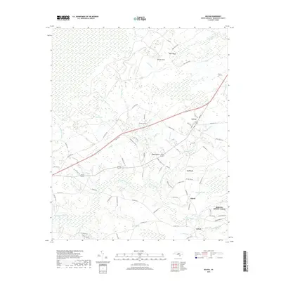
2019 Map of Bolivia
USGS Topo · Published 2019About this map
Bolivia stands as a focal point in this coastal plain landscape, where the town grid meets the winding corridors of the Lockwoods Folly River and Bell Swamp. The map reveals a high density of named water features and wetlands characteristic of Brunswick County, including the vast Green Swamp to the west and the uniquely named Half Hell and Half Hell Swamp to the south. This area is defined by its drainage patterns, with numerous runs and branches such as Red Run, Pinch Gut Cr, and Rattlesnake Br threading through the low-lying terrain.
Find a feature on this map
82 named features on this map. Tap any name to fly to it.
Don’t see what you’re looking for? This feature index may not catch every label — zoom into the map to look around manually.
Map Details
Editions of this 2019 Bolivia Map
This is the sole edition of this map. No revisions or reprints were ever made.
Other maps of this area

1943 · Funston
USGS Topo · 1:24,000

1943 · Honey Island
USGS Topo · 1:24,000

1943 · Holden Beach
USGS Topo · 1:24,000

1943 · Winnabow
USGS Topo · 1:24,000

1943 · Bolivia
USGS Topo · 1:24,000

1943 · Lockwoods Folly
USGS Topo · 1:24,000

1943 · Supply
USGS Topo · 1:24,000

1943 · Lewis Swamp
USGS Topo · 1:24,000

1944 · Supply
USGS Topo · 1:31,680

1944 · Bolivia
USGS Topo · 1:31,680