
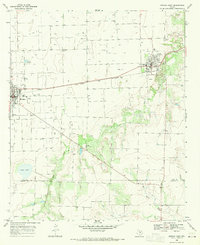
1966 Map of Bomarton
USGS Topo · Published 1969About this map
The Brazos River meanders across this West Texas landscape, defining the boundary between the Knox County and Baylor County lines. Along the southern edge, the settlement of Bomarton serves as a focal point near the Fort Worth and Denver railroad line, reflecting the importance of rail transport to these rural ranching and farming communities during the mid-1960s. The terrain is deeply dissected by numerous tributaries including Cottonwood Creek, Lake Creek, and Red Creek, which create a complex drainage pattern across the plains.
Find a feature on this map
15 named features on this map. Tap any name to fly to it.
Don’t see what you’re looking for? This feature index may not catch every label — zoom into the map to look around manually.
Map Details
Editions of this 1966 Bomarton Map
This is the sole edition of this map. No revisions or reprints were ever made.
Other maps of this area

1954 · Wichita Falls
USGS Topo · 1:250,000

1958 · Wichita Falls
USGS Topo · 1:250,000

1962 · Antelope Creek NE
USGS Topo · 1:24,000

1962 · Antelope Creek NW
USGS Topo · 1:24,000

1966 · Seymour West
USGS Topo · 1:24,000

1966 · Soap Creek
USGS Topo · 1:24,000

1966 · Vera
USGS Topo · 1:24,000

1966 · Southwest Lake Kemp
USGS Topo · 1:24,000

1967 · Hefner
USGS Topo · 1:24,000
1968 · Munday East
USGS Topo · 1:24,000