
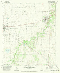
1967 Map of Hefner
USGS Topo · Published 1969About this map
The Brazos River meanders across this late-1960s landscape, carving wide bends through Knox County. Near the southern riverbanks, the small settlement of Hefner serves as a local focal point alongside the Friendship Cem, offering a glimpse into the rural community structure of the era. The terrain is defined by its agricultural and extractive utility, marked by numerous Oil Well sites and several Gravel Pit operations concentrated near the river's edge. Water sources are vital in this region, with Red Creek feeding into the main river channel and various isolated Spring and Springs points mapped across the plains. This survey reflects a mid-century Texas economy balanced between traditional farming and the growing footprint of petroleum extraction.
Find a feature on this map
8 named features on this map. Tap any name to fly to it.
Don’t see what you’re looking for? This feature index may not catch every label — zoom into the map to look around manually.
Map Details
Editions of this 1967 Hefner Map
This is the sole edition of this map. No revisions or reprints were ever made.
Other maps of this area

1954 · Wichita Falls
USGS Topo · 1:250,000

1958 · Wichita Falls
USGS Topo · 1:250,000

1962 · Antelope Creek NW
USGS Topo · 1:24,000

1966 · Soap Creek
USGS Topo · 1:24,000

1966 · Gilliland
USGS Topo · 1:24,000

1966 · Bomarton
USGS Topo · 1:24,000

1966 · Vera
USGS Topo · 1:24,000

1967 · Rhineland
USGS Topo · 1:24,000

1968 · Munday West
USGS Topo · 1:24,000
1968 · Munday East
USGS Topo · 1:24,000