
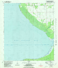
1980 Map of Bon Secour Bay
USGS Topo · Published 1985About this map
Bon Secour Bay dominates the landscape of this coastal Alabama survey, which captures the tidal margins and maritime infrastructure of Baldwin County in the early 1980s. The southern peninsula is anchored by the small settlement of Gasque and features significant local landmarks like Shellbank Ch and Miller Memorial Cem. The map illustrates a transitional period for the shoreline, with several areas updated through photorevisions to reflect changes in woodland and coastal features.
Find a feature on this map
13 named features on this map. Tap any name to fly to it.
Don’t see what you’re looking for? This feature index may not catch every label — zoom into the map to look around manually.
Map Details
Editions of this 1980 Bon Secour Bay Map
2 editions found
Other maps of this area

1921 · Bon Secour
USGS Topo · 1:62,500

1921 · Point Clear
USGS Topo · 1:62,500

1941 · Foley
USGS Topo · 1:62,500

1941 · Weeks Bay
USGS Topo · 1:62,500

1943 · Weeks Bay
USGS Topo · 1:62,500

1943 · Foley
USGS Topo · 1:62,500
1956 · Point Clear
USGS Topo · 1:24,000

1957 · Pensacola
USGS Topo · 1:250,000

1959 · Pensacola
USGS Topo · 1:250,000

1960 · Pensacola
USGS Topo · 1:250,000