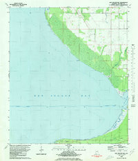
1980 Map of Bon Secour Bay
USGS Topo · Published 1980About this map
Bon Secour Bay dominates this coastal survey, where the saltwater of the Gulf meets a network of slow-moving bayous and creeks. The landscape is defined by the heavy marshlands around Cypress Pt and the prominent Seymour Bluff along the southern shoreline. Transportation and maritime commerce are centralized along the Intracoastal Waterway, which cuts a straight path across the open water, marked by various navigational lights.
Find a feature on this map
14 named features on this map. Tap any name to fly to it.
Don’t see what you’re looking for? This feature index may not catch every label — zoom into the map to look around manually.
Map Details
Editions of this 1980 Bon Secour Bay Map
2 editions found

Other maps of this area

1921 · Bon Secour
USGS Topo · 1:62,500

1921 · Point Clear
USGS Topo · 1:62,500

1941 · Foley
USGS Topo · 1:62,500

1941 · Weeks Bay
USGS Topo · 1:62,500

1943 · Weeks Bay
USGS Topo · 1:62,500

1943 · Foley
USGS Topo · 1:62,500
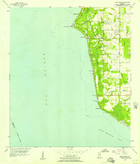
1956 · Point Clear
USGS Topo · 1:24,000

1957 · Pensacola
USGS Topo · 1:250,000

1959 · Pensacola
USGS Topo · 1:250,000

1960 · Pensacola
USGS Topo · 1:250,000