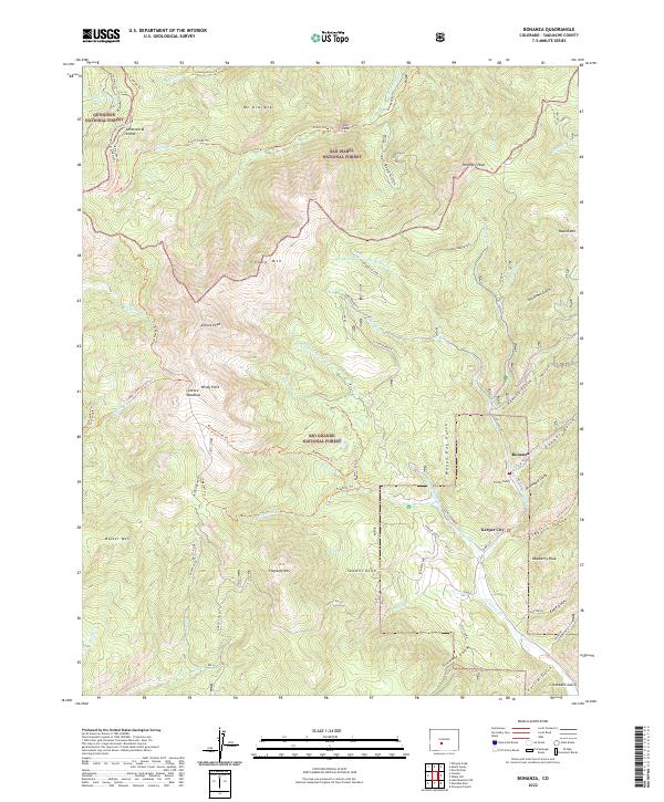
2022 Map of Bonanza
USGS Topo · Published 2022About this map
Bonanza and Kerber City occupy a high-elevation drainage where three national forests meet: the Rio Grande, San Isabel, and Gunnison. This terrain is deeply etched by mining history and transit, notably along the Continental Divide National Scenic Trail and the Colorado Trail. The landscape is defined by its steep gulches, such as Graveyard Gulch and Wagon Box Gulch, which descend toward Kerber Creek. High peaks like Antora Peak and Sheep Mountain overlook the remnants of industrial efforts, including the Klondike Mine and various roads like Co RD ll56. The layout of the region, with its Antora Meadows and secluded Mosquito Lake, reflects a classic Colorado pattern of high-country mineral extraction followed by a shift toward recreational and conservation land management.
Find a feature on this map
74 named features on this map. Tap any name to fly to it.
Don’t see what you’re looking for? This feature index may not catch every label — zoom into the map to look around manually.
Map Details
Editions of this 2022 Bonanza Map
This is the sole edition of this map. No revisions or reprints were ever made.
Other maps of this area

1956 · Montrose
USGS Topo · 1:250,000

1959 · Montrose
USGS Topo · 1:250,000

1959 · Bonanza
USGS Topo · 1:62,500

1960 · Montrose
USGS Topo · 1:250,000

1967 · Lake Mountain NE
USGS Topo · 1:24,000

1967 · Chester
USGS Topo · 1:24,000

1967 · Pahlone Peak
USGS Topo · 1:24,000
1967 · Klondike Mine
USGS Topo · 1:24,000
1967 · Graveyard Gulch
USGS Topo · 1:24,000

1968 · Montrose
USGS Topo · 1:250,000