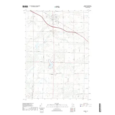
2018 Map of Bonduel
USGS Topo · Published 2018About this map
Bonduel anchors the northern portion of this landscape, where the local road network converges at the intersection of State St and S Cecil St. This village serves as a central hub for the surrounding agricultural lands, which are dotted with smaller settlements like Slab City and Landstad. The terrain is defined by a complex drainage system, featuring the Pensaukee River in the northeast and the expansive Navarino Marsh in the west. These wetlands, along with White Lake, suggest a low-lying environment where water management has historically shaped land use and transportation routes.
Find a feature on this map
85 named features on this map. Tap any name to fly to it.
Don’t see what you’re looking for? This feature index may not catch every label — zoom into the map to look around manually.
Map Details
Editions of this 2018 Bonduel Map
This is the sole edition of this map. No revisions or reprints were ever made.
Other maps of this area

1954 · Shawano
USGS Topo · 1:48,000

1955 · Embarrass
USGS Topo · 1:48,000

1955 · Seymour
USGS Topo · 1:62,500

1955 · Green Bay
USGS Topo · 1:250,000

1956 · Gillett
USGS Topo · 1:62,500

1964 · Shawano
USGS Topo · 1:62,500

1969 · Leeman
USGS Topo · 1:24,000

1969 · Lunds
USGS Topo · 1:24,000

1974 · Seymour
USGS Topo · 1:24,000

1974 · Cecil
USGS Topo · 1:24,000